


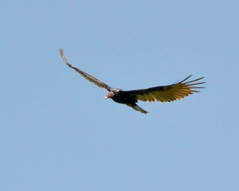
There were any number of intriguing encounters on the walk, such as the black-crested titmouse, the sparrow and the dragonfly. The turkey vulture gave me another demonstration of their aerial abilities. One thing I find interesting are the shapes that dead branches can have:


The weather was beautiful following the arrival of the first cool front of the season. There was a north wind blowing at 20 to 25 mph. It was refreshing just to hear the sound of the wind blowing through the trees. I began to wonder how the sound of the wind could be included photographically. Here is the best way I could think of doing that:


While the wind brought relief from the 100+ degree temperatures, combined with the exceptional drought conditions, it created an extreme danger of wildfires. The wildfire burning out of control in Bastrop County about a hundred miles or so to the northeast was very much on my mind on my walk today. Then when I was driving home and was just north of downtown on U. S. 281, I could see the plume of smoke from the Stone Oak Park fire in North Bexar County. There were at least two other wildfires in Bexar County today.
The danger of wildfires has been a major concern for me ever since my walk through Eisenhower Park on June 6th. The Stone Oak fire was started by a San Antonio Water System truck that parked in tall grass so a crew could access a manhole. Given the current conditions it takes so little to start a major wildfire.
When I left the Upland Trailhead following my walk on August 19, there was a grass fire burning just southwest of the Loop 1604, Highway 16 intersection. I even cropped one of the photos from that day's walk to eliminate the plume of smoke above the trees.
I have really been surprised there haven't been more wildfires. I took the following photos to show why there is such a danger of wildfire. An ember from a barbeque, a carelessly tossed lit cigarette butt, or anything similar would easily set this woodland ablaze:


Once again, there are a couple more sets of photos from my walk today that will be included in upcoming posts.
No comments:
Post a Comment