Thursday, July 14, 2011

The San Antonio River, Mission Reach, The Restoration Process

Since McAllister Park is a convenient location relative to other places I have to be this week, this was a good time for me to walk the trails there. However, my intuition is telling me it is time for a bit of a change of pace in the photos for today's post.

Based on the blog pageview statistics, I can see that the San Antonio River Mission Reach photos have been the most popular While on a Walk posts thus far. My thanks to all who have visited this site as a result of web searches for that topic.

The river landscape design and engineering for this section of the river restoration project has been quite remarkable. The San Antonio River Authority and the San Antonio River Improvements Project have published much information about the restoration process and have included it in information signage along the trail.

Restoring a river that was channelized strictly for flood control purposes about fifty years ago to a more natural ecosystem is no small task. One of the primary goals of the restoration project has been to recreate a diverse river ecosystem within the constraints of the flood control channel that includes runs, pools, weirs, riffles and embayments.

On my walks along the Mission Reach section of the river, I haven't taken many photos that show the actual process of this restoration partly because the process is in a relatively early stage of development and because my main intent has been to concentrate on the wildlife.

I do have a few photos that at least show something of the process involved:


South of Theo Ave, the flood channel widens allowing room for the construction of a fairly large embayment area. An embayment is created where a river has meandered, leaving still water pools in the process. It is a similar process to what occurs on large rivers creating oxbow lakes:


Eventually, when I return to the Mission Reach, I will make a point of taking photos that more effectively show the process of restoration. For now, this can be considered a preview of a future post.


Wednesday, July 13, 2011

McAllister Park, Walk #2

Today's photos:


This morning, I walked the paved loop trail southeast of the Al Becken Pavilion. I had no intention when I set out on my walk for this to be a continuation of yesterday's post, but I wasn't very far along the trail before I saw a couple deer off to the right of the trail.

Before I had gone halfway round the loop, I had seen so many deer I have to admit I felt they were becoming a distraction. Not that they aren't magnificent creatures, but something wasn't feeling quite right about the experience.

As I headed the last couple hundred yards back to the car, I realized what was happening. There was a person at one of the picnic areas along the road feeding a small herd of seven or eight deer.

This is a section of the park with numerous picnic areas. The relatively large concentration of deer in this area is not entirely natural. In this case, the human presence and the generous supply of food they give to the deer have altered the situation. These definitely aren't wild deer.

Tuesday, July 12, 2011

White-tailed Deer; Urban Wildlife

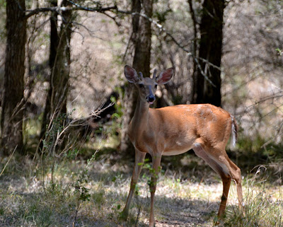
I had mentioned in a previous post that white-tailed deer are very common in many areas of San Antonio north of Loop 410. Deer are one of the larger, normally free ranging animals that, given an adequate amount of green space, can adapt surprisingly well to the urban environment.

While they tend to remain elusive, there are many deer in McAllister Park. I happened on three of them during my walk yesterday and this time managed to get a few photos:


The following photos are an older fawn of the doe in the first three photos. The fawn was about thirty yards from its mother, so I was able to get photos of both without moving to a new location:


Later on my walk, I happened across another doe. Actually, I had seen it cross a dry creek bed and head into some heavy underbrush. I new generally what direction it had gone and that the trail I was walking would come fairly close to where it likely stopped. All I had to do then was stay alert and try not to spook it as I approached:


As I have also mentioned in previous posts, these are the experiences that keep me going back for more.

Monday, July 11, 2011

McAllister Park, Walk #1

Today's photos:


The land for McAllister Park was purchased by the City of San Antonio in 1968 and until 1974 was called the Northeast Preserve. I have many fond memories of spending time with friends in this park in the early 1970's during my early years in San Antonio. Both the park and especially the surrounding land have changed dramatically since those days.

In the early '70s, most of the land north of Loop 410 between Interstates 35 and 10 was still farm land. Subdivisions were just beginning to be developed primarily along the IH 10 and U.S. 281 corridors. The land surrounding McAllister Park is now heavily developed and the park itself has been transformed from a wildlife preserve to a multi-use facility that includes numerous sports fields.

Regardless of the development, the park remains one of the premiere wildlife areas within this heavily urbanized area of the city. It is one of the largest parks in San Antonio. There are about 15 miles of trails: approximately 5 miles paved and 10 miles unpaved. Unfortunately, other than the two unpaved trails, the red trail and the blue loop, the trails are unnamed. Thus the title for this series will be by number. Today I walked west and somewhat to the south of the Al Becken Pavilion.

Tomorrow's post will be another "highlight" set of photos from today's walk.