San Antonio River, Mission Reach, Confluence Park Trailhead downstream
to the 3.6 mile marker*
Today's photos:


- The first photo is an Alamo Vine flower.
- The second photo is a Snowy Egret searching for food at the top of a riffle.
- The third photo is an inflorescence of Sideoats Grama (the State Grass of Texas). A tiny caterpillar of some sort has woven itself inside a web pulling the spike of the inflorescence into an oval. I would have liked to have seen how the caterpillar accomplished this.
- The fourth and fifth photos are of a Little Yellow butterfly on Orange Milkweed flowers. These milkweed blossoms were attracting numerous butterflies. Another common name for this plant is Butterfly-Weed, for obvious reasons.
- The sixth photo is a Bordered Patch butterfly on the Orange Milkweed.
- The seventh photo is a Bordered Patch butterfly on a Maximilian Sunflower. The Common Sunflowers have been in bloom for a couple of months, but the Maximilian Sunflowers are just beginning to flower.
- The eighth and ninth photos are of a Yellow-crowned Night-Heron.
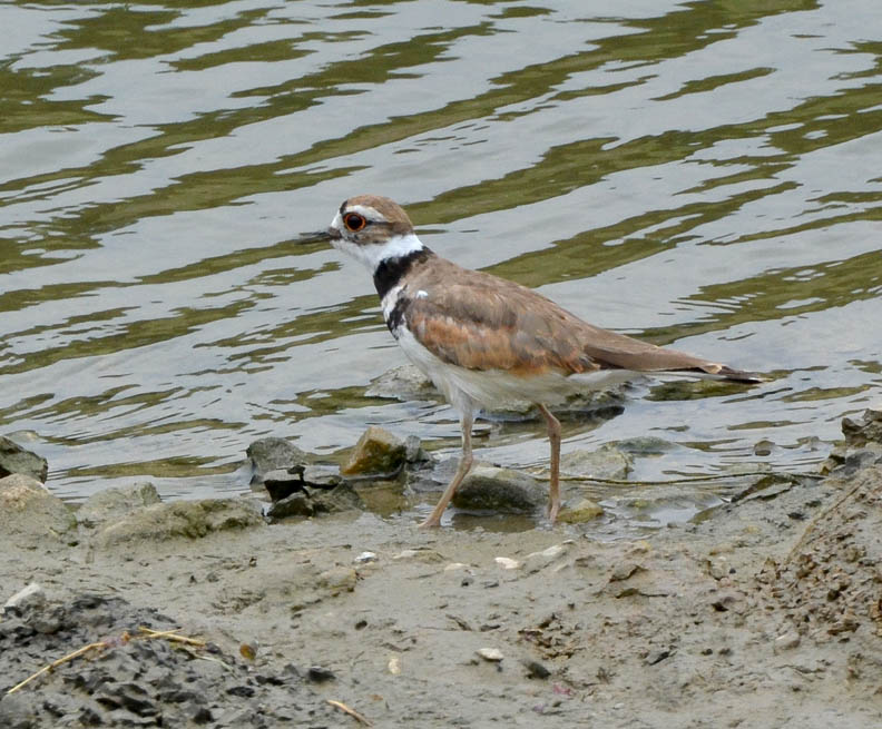
- The tenth photo is a Killdeer.
- The eleventh photo is a Neotropic Cormorant.
- The twelfth photo is a Blue-fronted Dancer (Argia apicalis) damselfly I managed to photograph inflight. This damselfly was being very cooperative while I took its photo as it hovered in more or less the same location until I turned away.
- The thirteenth photo is a slider turtle sunning itself on the recently exposed bedrock along the riverbank. From this distance the rock appears to be a relatively soft limestone aggregate. This section of the bank on the west side of the River just south of the Theo Ave bridge was severely eroded by the May 25th flood, but it revealed this fascinating rock formation.
- The fourteenth through sixteenth photos are of Partridge Pea flowers.
- The seventeenth photo is a Standing Cypress that is still in bloom.
* Along the San Antonio River Greenway Trails, there are small, roughly three inch diameter circular bronze insets with a number embedded in the center of the trail generally every two-tenths of a mile. These numbers indicate the distance in miles from the center of Main Plaza downtown. So, the 3.6 marker on the east bank trail south of Theo Ave. is 3.6 miles along the trail from Main Plaza.
The mile markers, beginning with zero, also are located north of Main Plaza. If one started at the 2.4 marker north of downtown and walked downstream to the 3.6 marker south of Theo, the total distance walked would be six miles (2.4 miles + 3.6 miles).