Monday, July 1, 2013
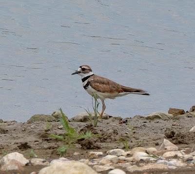
San Antonio River, Mission Reach, Mission Rd Trailhead downstream
Today's photos:
I really have been out taking a plethora of photos since April, even if there has only been one post since Earth Day. As the saying goes, there has been a lot of water under the bridge since then. Quite literally, there was a whole lot of water under the bridge during the major flood on May 25th with a record setting high crest on the San Antonio River under the Loop 410 South bridge.
The phrase "water under the bridge" typically refers to something in the past that is no longer important. All that has transpired since April 22nd is in the past, but still has significance both in the consequences of the events and in the lessons that must always be learned.
If all stays on course, I will discuss some of those events, their consequences and the lessons learned in an upcoming post. I have learned much in the past three months. For now, suffice it to say I did take a short walk along the River on Monday. I observed much, but took few photographs compared to my usual walks.
I'm not sure I can verbalize exactly why this Killdeer communicates my experience. I am probably projecting my own perceptions on it. Even after having had some time to study the photos, I still have a feeling this beautiful, wide-eyed bird was trying to re-orient itself to the changes in the post-flood river channel more than a month after the great flood of 2013.
Note: The San Antonio River Authority (SARA) has made considerable progress in reopening the Mission Reach trails damaged in the flood, however there is still much work to be done. If you are planning to visit the Mission Reach during the 4th of July holiday, please check SARA's website where there is an update with a link to a map showing current trail closures.


No comments:
Post a Comment